Your Guide To The Best New Jersey Fall Trips

With New Jersey's fall colors at their peak well into November, Fall Trips, whether they be for a day or weekend, makes for a memorable experience
New Jersey, with the turning of the fall foliage to bright colors is second to New England. Watching the leaves turn in NJ is one of the most romantic things you can do in the fall, even if only to for a day trip to check out the scenery.
In New Jersey, fall colors tend to peak around Columbus Day Weekend, with many of the ridges maintaining their golden shades into November. Fall, followed by dry summer weather, will often see the swamp maples, ash and other shallow rooted trees turn early
While foliage conditions vary from year to year, the best fall colors begin in Northern NJ, and appear further south with fall colors still in bloom in southern new jersey - Pine Barrens as late as Mid/late October into early November.
Northern New Jersey Fall Trips & Scenic Drives

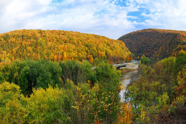
Take a ride on Jersey's mountainous forested region to view the vibrant colors of Fall. It can be enjoyed as either a day trip, or as a leisurely weekend getaway by taking many of the rural stop off points. With 70,000 acres of land, this recreational area is rich in flora, especially in red maples.
Begin your fall scenic drive in the town of Newton has a historic Revolutionary War past with many colonial-style dwellings and antique shops. Take Rt 94 East heading toward Rt Route 206 Lafayette. Head north to the entrance of Sunrise Mountain and Stokes State Forest in Sandyston. For the casual driver, the 7 mile Sunrise Mountain Overlook is a scenic loop and is one of the most frequently visited sites in Stokes State Forest. The mountaintop provides a breathtaking view at an elevation of 1,653 feet above sea level. The Appalachian Trail runs along the ridge. Once in the park there are many signs that point you to Stokes State Forest and High Point State Park.
Continue to High Point State Park and Monument, the highest point in New Jersey at 1,803' above sea level. The Monument affords a spectacular 360-degree view of three states and the Delaware River valley.
Continue down Rt 206 to Peters Valley Peters valley is known for its fine crafts workshops and serves as the northern entrance to the Delaware Water Gap National Recreation Area. Continue further south to Wallpack Center via Rt 615.

Buttermilk Falls
If you are slightly adventurous, continue further on to Buttermilk Falls cascading down the steep side of Kittatinny Mountain. (See below this page for Best Fall Hiking Trails)

Prospect Avenue and Eagle Rock Avenue
West Orange, NJ
Website
This 400+ acre park along the Watchung Mountains ridge line features the 36 mile Lenape Trail along the eastern edge of the park. The hiking trails and footpaths that crisscross the woodland (and sometimes boggy) areas of the park are friendly for hikers of all ages and abilities..The main entrance to the park, located on Eagle Rock Avenue, is home to the Essex County 9/11 Memorial and overlook to the east with extraordinary views of the New York City Skyline.
The Lenape Trail named for the native Americans who once inhabitated Northern NJ, connects 18 parks and 11 municipalities in Essex County. A guide to the trail, including comprehensive trail maps can be found here.

72 McBride Avenue
Paterson, NJ
Learn more
The falls now 77 feet high, emerged approximately 13,000 years ago the end of the ice age. As the glaciers ice melted, the Passaic river swelled and rerouted it's way around the north end of the Watchung Mountains, carving out the spectacular falls from the basalt base.
The falls can best be viewed from three spots; Great Falls Lawn View, from the Great Falls bridge, and Overlook Park.
You can tour alone or with guided walking tours daily at 11:00 am and 3:00 pm.

Travel the Old Mine Road
A New Jersey Historic and Scenic Treasure, this is a scenic route recorded in the National Register of Historic Places and is considered to be one of the oldest roads in the United States, running 104 miles from the southern most point at Kittatinny Point Visitor Center in Hardwick Township, NJ to Kingston, NY
More info

Photo Courtesy Palisades Interstate Park Commission
Palisades Scenic Byway
Beginning in Fort Lee, NJ, either take the 11 mile route along the Palisades Interstate Parkway or the 9 mile drive along Henry Hudson Drive
The Palisades Interstate Parkway north, runs through 2,500 acres of parkland ending at the New York state border. It offers awesome views of the Hudson River and Manhattan skyline from the 500-foot tall Palisades Cliffs that the byway rests upon. Parallel to the byway at the river level are a number of facilities for the public that are connected by a scenic river drive.
The Byway takes you along a scenic route on top of the cliffs and the Henry Hudson Drive located between the Parkway and the Hudson River. Travelers get to enjoy spectacular views of the Palisades, the Hudson River and the New York City skyline. Three scenic overlooks are accessible from the Parkway and include Rockefeller Lookout, Alpine Lookout and the popular State Line Lookout, which is located on the highest point on the Palisades cliffs (532 feet). Several river access points are available from Henry Hudson Drive and include Hazard's Ramp Public Boat Launch, Ross Dock Picnic Area, Englewood Picnic Area and Boat Basin, and Undercliff Picnic Area. The park also includes hiking trails, a nature sanctuary, historic sites and the Fort Lee Historic Park providing information on the significant role Fort Lee played in the American Revolutionary War

1160 Summit Ln
Mountainside, NJ
(908) 789-3665
Website
The Watchung Reservation, located in the heart of Union County between routes 78 and 22, is a fall scenic wonderland that encompasses the ridges of the first and second Watchung Mountains, including over 2,000 acres of protected forest and a myriad of hiking trails, lakes, and historical sites. The Reservation has over 13 miles of well-maintained, clearly marked hiking trails. Popular attractions include Blue Brook a stream that flows over a dam creating Lake Surprise, and the abandoned Deserted Village. Visitors can access the village and take a self-guided walking tour to learn about fascinating history and its strange legends. For a popular fall activity, you can take the Haunted Hayride, which travels through the Deserted Village during the Halloween season.
Don't miss out on the Trailside Nature and Science Center. For a family activity with kids, there are interactive displays and exhibits like the Lenape Native Americans Backyard Habitat.
To cap off your scenic fall trip, head over to Seeley's Pond, created in the late 19th century, was used to power a mill. There are easy hiking paths that encircle the pond with vibrant-colored trees and waterfalls.
Central New Jersey Fall Trips & Scenic Drives

4263 Atlantic Ave
Farmingdale, NJ
Website
Visitors will get to visit the variety of historic buildings that remain on their original foundations. The museum portrays early 19th century industrial community life, complete with interactive displays, hands-on-activities, and costumed period interpreters in 13 historic homes, craft shops, a chapel, a store, a bakery, exhibit halls, and other buildings.
There are over 200 different species of wildflowers, trees, and plants can be found within the Park, and The Pine Creek Railroad that offers a vintage train ride. In the Fall there are a number of popular events including the performance of The Legend of Sleepy Hollow and the Fall Craft Show.

Clinton, NJ
A picturesque, widely photographed small town with a tree lined downtown filled with shops and restaurants and an attractive river with an old grist mill and 200 foot wide waterfall winding through it.
More info

Photo Courtesy Hunterdon County
Green Sergeant's Covered Bridge, Stockton, NJ
A wooden covered bridge over the Wickecheoke Creek In Stockton, NJ near the border between the Hunterdon Plateau and Amwell Valley. It is the last covered bridge in the state of New Jersey, it is listed on the National Register of Historic Places. The bridge was first constructed in 1872, but after being damaged in 1960, it was dismantled and rebuilt from the original materials in 1961. While in Stockton check out the oldest three room school house in New Jersey. Established in 1872, it is still in operation today. Stockton School is well known for its small classes that give individual attention to each student and is compared frequently with local private schools. Also visit Prallsville Mills listed on the National Register of Historic Places and is located in the D & R Canal State Park. This stone grist mill was an important commercial center during the 19th century and continued in operation until the 1950's. Today the Mill is a resource for a wide variety of cultural, arts and community activities while also providing docent tours of the Mill Complex and the recently preserved miller's house, the John Prall Jr. House.

360 County Road 579
Asbury, NJ
(908) 940-4115
Website
At this 108 acre transitional organic farm ,known for it's apple cider, you can learn about their regenerative farming practices, get to see pigs, chickens, heritage turkeys, and topping it off with a feast in their cider garden (reservations recommended).with their 30 foot high chimney of an Argentine styled open -fire grill while seated at wooden tables under the covered woodshed where guests get a chance to watch their chefs work around the Mother Fire open fire grills.
Ironbound Farm is one of several destinations on the new Hunterdon 570 Trail, named for Cty Rte 579, which runs from Lambertville to Bloomsbury.

Learn more
Southern New Jersey Fall Trips & Scenic Drives

24 Kimbles Beach Road
Cape May Court House, NJ
609-463-0994
Learn More
The Refuge is open daily from sunrise to sunset. Website The Cape May National Wildlife Refuge is one of the largest in the National Wildlife system. It was established to protect migratory birds along New Jersey's coastline. The refuge is currently at 11,000 acres and is made up of three units; the Delaware Bay Division, the Great Cedar Swamp Division, and the Two Mile Beach Unit, and there are plans to expand the Refuge to 21,200 acres.
For both amateur and serious eco-tourists, fall is the perfect time to visit Cape May. Binoculars replace bikinis, cameras are more important than beach chairs. Visitors to the Cape May National Wildlife Refuge and Cape May Point State Park can spot scores of birds and butterflies and add to their life list throughout the fall as they migrate south. The Monarch butterfly migration usually begins in late September and continues through mid October. including hawks passing through during the fall as they head south.

109 Boulevard Route 50
Mays Landing, NJ
Website
(609) 625-1897
After the Native Americans, this was land owned by the Estell family and was the site of a glassworks in the 1800's, then became the site of a munitions plant during World War I. After 70 years, the forest has reclaimed this area, and is now home to an incredible diversity of plants and animals.
The park is also home to The Warren E. Fox Nature Center where most of their environmental education and recreation programs are held. The center has environmental and live animal displays, as well as maps and brochures, restroom facilities, and environmental information..

Begin your journey in Chatsworth (Rt 532 & Rt 563) a historic cranberry town. Plan your trip in October and take in Chatsworth Cranberry Festival. This is a celebration of New Jersey's cranberry harvest, the 3rd largest in the United States, and offers a tribute to the Pine Barrens & Local Culture. In Shamong, NJ, you rent a canoe or a kayak at Pinelands Adventure and do some flat water paddling. Batsto Village located in Wharton State Forest is ideal for an historic visit back to the iron and glass making era. Today, many of the buildings have been preserved and modern crafts people still ply their trades. Wharton State Forest. This forest is the largest in the state - over 110,000 acres of land in Burlington, Atlantic and Camden counties. Expect to see stunning foliage views along with some bald eagles, red-tailed hawks, and many other birds.
The Bass River State Forest in Burlington County is another site for great views. The 67-acre Lake Absegami provides enough moisture for leaves to shine bright.

Photo Courtesy User:JSF0864 on Flickr for releasing this photo under a free license
Scarborough Bridge - Cherry Hill
One of two covered bridges still standing in New Jersey was designed by famed architect Malcolm Wells and built across the Cooper River's north branch. This covered Bridge,joins two sections of the Barclay Farm neighborhood off NJ Route 70 in Cherry Hill. It was dedicated on Valentine's Day in 1959 as 101 couples kissed to mark the tradition of the Kissing or Friendship Bridge
Best Fall Hiking Trails
Buttermilk Falls Loop (see photo at top of page)
Difficulty: Moderate. The entire loop covers 7.5 miles R/T and includes 3 waterfalls, cascades, and good views. As a note of caution, trails are not well marked. Buttermilk Falls is NJ's highest waterfall at 200' high. It requires virtually no hiking to see it, though there are other short stair climbing and trails to get to see other views.
From the falls, you can follow markers to the blue trail, which leads to the white Appalachian trail. For the shortest loop, climb up the stairs around the falls and continue on the Blue trail at the top. At the beginning there is a steep climb, though the views at the top are well worth it. Consider stopping at Tillman Ravine on the way to the Falls and doing a couple mile hike around there, and then stopping at Buttermilk for a look. To get there: From Branchville, take Rt. 206 N, past Culver's Lake, make a left onto Struble Road where it becomes Dimon Road. Continue on past two parking areas on the left for Tillman Ravine. At the intersection, turn left onto Mountain Road, past Walpack Cemetery. Continue on Mountain Road until you see a large dirt lot on your right, the falls on are the left right next to the road and can't be missed. GPS Parking: N41 08.221 W74 53.350 Note: Rest rooms are the two Tillman Ravine parking lots on Mountain Rd.
Southerly approach to Sunrise Mtn. - Stokes Forest
Difficulty: Easy It offers great views over 7 miles r/t on a well maintained Trail. Near: Branchville, NJ Scenery: Distance: 7 miles round trip Elevation Gain:
Mt. Tammany - Delaware Water Gap
Difficulty: Moderate to Difficult. One of the most popular trails in New Jersey. It traverses the Appalachian Trail and offers great panoramic views of the Delaware Water Gap and Mt. Minsi across the Delaware River in Pennsylvania. The Red Dot Trail is the more steeper at 1.2 miles to the summit. The Blue Dot Trail is more gradual and a little longer at 1.4 miles. At the top of the summit you will reach Indian head be rewarded with an awesome, much photographed panoramic view of the Gap.
Parking/Trail head: Begin your journey by first stopping at the Kittatinny Point Visitor center (908-496-4458). In early fall it's open only 3 days a week. Take Route 80 west to Exit 1 and bear left 1/4 mile. On the right there is a sign for Dunnfield Creek Natural Area. There is a parking lot on the right, then a large main lot in the center.
Pyramid Mountain – Tripod Rock
Difficulty; Moderate but interesting for experienced hikers. 4.6 miles R/T with a variety of short to medium trail loops with moderate elevation gains, rocky footpaths, several streams, interesting glacial erratics in a beautiful setting. Parking: Rt 287 to exit 45. 472 A Boonton Avenue, Montville Township, NJ
The Lockwood Gorge Wildlife Management Area and the Columbia Trail, High Bridge
7.5 miles of an easy trail that can be completed in 3 hours. Hikers can enjoy a stroll along the unpaved road that parallels the river without interruption by vehicular traffic, It parallels the South Branch of the Raritan River through a deep gorge, one of the most beautiful spots in New Jersey.
Parking/Trail head: 609-984-0547. take I-78 to exit 17 (westbound) or exit 16 (eastbound) for Route 31 towards Washington. Drive about 2 miles on Route 31 then turn right on Main Street. In 1.1 miles turn right on Bridge Street, proceed 390 feet, then left on Main Street. Continue for .2 mile through town then turn left at The Commons sign to the parking lot.
Recommended Places To Stay
Alpine Haus
Vernon, NJ

Reviews/Booking
Chestnut hill
Milford, NJ

Reviews/Booking
Cascades Lodge
Hamburg, NJ

Reviews/Booking
Riverside Victorian
Clinton, NJ

Reviews & booking
Whistling Swan Inn
Stanhope, NJ

Reviews & booking
The Ambersand Inn
Newton, NJ

Reviews/Booking